

Main Navigation
Main Content
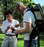
Guangxing Wang
Guangxing Wang, Professor, Remote Sensing and GIS
Geography and Environmental Resources
Dr. Wang's research interests include remote sensing, GIS, spatial statistics and their applications to geography, natural and environmental resources with the specific areas: sampling design strategies; human activity and natural disaster induced vegetation disturbance and soil erosion, environmental quality assessment; forest and city vegetation carbon sequestration modeling and mapping; wetland classification and dynamics monitoring; desertification trend monitoring; quality assessment and spatial uncertainty analysis of remote sensing and GIS products.
Education
Ph.D. Remote Sensing of Forest Resources, University of Helsinki, Finland, 1996
M.Sc. Forest Biometrics, Central South University of Forestry and Technology, China, 1985
B.S. Forestry, Central South University of Forestry and Technology, China, 1982
Selection Of Courses Taught
- Geog 401: Introduction To Gis
- GEOG 404: Spatial Analysis
- GEOG 406: Intro to Remote Sensing
- GEOG 408: Advanced Remote Sensing
- GEOG 416: Cartographic Design
- GEOG 490: Reading in Geography
- GEOG 501: Seminars in Geography and Environmental Research
Recent Publications
Wang, Q., H. Sun, R. Li., G. Wang. 2019 A new stochastic simulation algorithm for image-based classification: Feature-space indicator simulation. ISPRS Journal of Photogrammetry and Remote Sensing. 152: 145-165.
Yu, H., R Li, G. Wang, Q Wang. 2019. Current development of landscape geochemistry with support of geospatial technologies: A review. Critical Reviews in Environmental Science and Technology 49(9): https://doi.org/10.1080/10643389.2018.1558890.
Mundia, C.W., Silvia Secchi, Kofi Akamani, G. Wang. 2019. A Regional Comparison of Factors Affecting Global Sorghum Production: The Case of North America, Asia and Africa’s Sahel. Sustainability 2019, 11(7), 2135; https://doi.org/10.3390/su11072135.
Liu, Q., L Fu, G Wang, S Li, Z Li, E Chen, Y Pang, K Hu. 2019. Improving Estimation of Forest Canopy Cover by Introducing Loss Ratio of Laser Pulses Using Airborne LiDAR. IEEE Transactions on Geoscience and Remote Sensing 58 (1), 567-585.
Wang, M, Q. Liu, L. Fu, G. Wang, X. Zhang. 2019. Airborne LIDAR-Derived Aboveground Biomass Estimates Using a Hierarchical Bayesian Approach. Remote Sens. 2019, 11, 1050; doi:10.3390/rs11091050.
Ameer H. Al-Ahmadi, Arjun Subedi, G. Wang, Ruplal Choudhary, Ahmad Fakhoury, Dennis G. Watson. 2018. Detection of Charcoal Rot (Macrophomina phaseolina) Toxin Effects in Soybean (Glycine max) Seedlings using Hyperspectral Spectroscopy. Computers and Electronics in Agriculture 150(2018) 188-195.
Rijal, S., G. Wang, Philip B. Woodford, Heidi R. Howard, J.M. Shawn Hutchinson, Stacy Hutchinson, Justin Schoof, Tonny J. Oyana, Ruopu Li, Logan O. Park. 2018. Detection of gullies in Fort Riley Military Installation using LiDAR derived high resolution DEM. Journal of Terramechanics 77, 15-22.
Rijal, S., G. Wang*, P.B. Woodford, H.R. Howard, J. Schoof, T. Oyana, L.O. Park, and R. Li. 2017. Comparison of military and non-military land condition using an image derived soil erosion cover factor. Journal of Soil and Water Conservation 72(5):425-437.
Fu, L., Qingwang Liu, Hua Sun, Zengyuan Li, Erxue Chen, Yong Pang, Shouzheng Tang, Xinyu Song, G. Wang*. 2018. Developing a system of compatible individual tree diameter and aboveground biomass prediction models using error-in-variable regression and airborne LiDAR data. Remote Sensing 10, 325; doi:10.3390/rs10020325.
Fu, L., R.P. Sharma, G. Wang, and S. Tang. 2017. Modelling a system of nonlinear additive crown width models applying seemingly unrelated regression for Prince Rupprecht larch in northern China. Forest Ecology and Management, 386, 71-80. https://dx.doi.org/10.1016/j.foreco.2016.11.038.
Recent Grants
PI: Unmanned Aircraft Systems (UASs) Based Vegetation Cover and Disturbance Mapping and Dynamic Monitoring, and Comparisons with Other Methods for Military Installations. Great River Cooperative Ecosystem Studies Units (CESU) National Network through Construction Engineering Research Laboratory (CERL), US$185,969, 08/01/2018 – 07/31/2022.
PI: Multi-source and Multi-scale Data Analysis and Quality Assessment for mapping and dynamically monitoring permafrost vulnerability for the installations of Alaska. Great River Cooperative Ecosystem Studies Units (CESU) National Network through Construction Engineering Research Laboratory (CERL), US$159,489, 01/01/2017 – 03/31/2020.
gxwang@siu.edu
Phone: 618-453-6017
Office: 4442 Faner Hall
Scholar Profile
CV (pdf)